Geofences
Geofences are geographical zones that can be used to generate events about device movement in and out of the zone.
There are three supported geometry types:
Polygon
Polyline
Circle
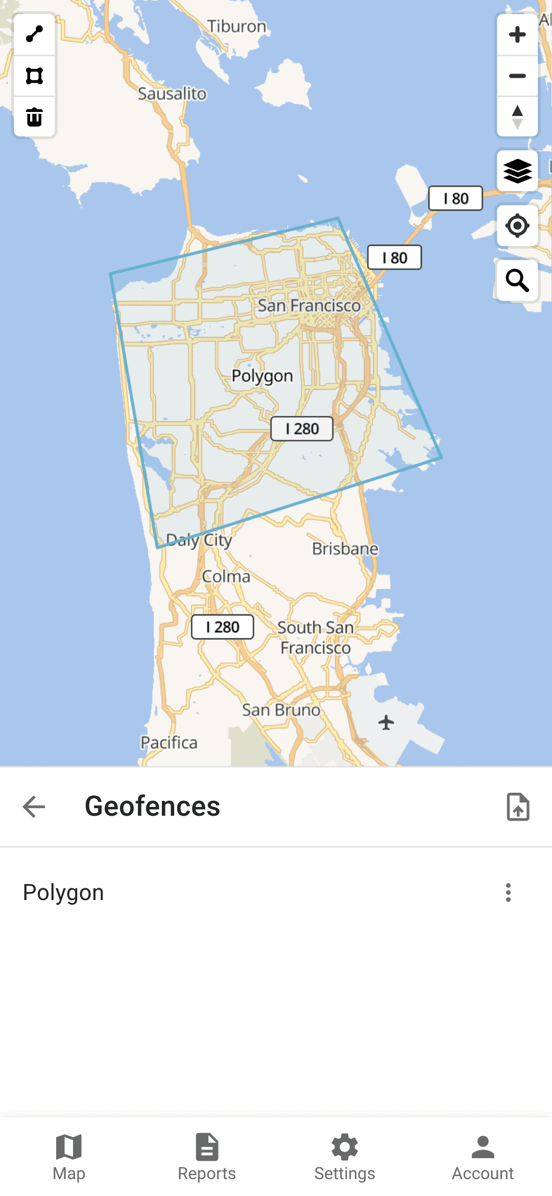
Polygon Geofence
A polygon geofence is a user-defined geographical boundary consisting of multiple vertices that form a closed shape. This type of geofence allows for precise and customizable area monitoring, enabling the system to detect and generate events when a device enters or exits the defined polygonal zone. Polygon geofences are particularly useful for irregularly shaped areas where circular or rectangular boundaries are insufficient.
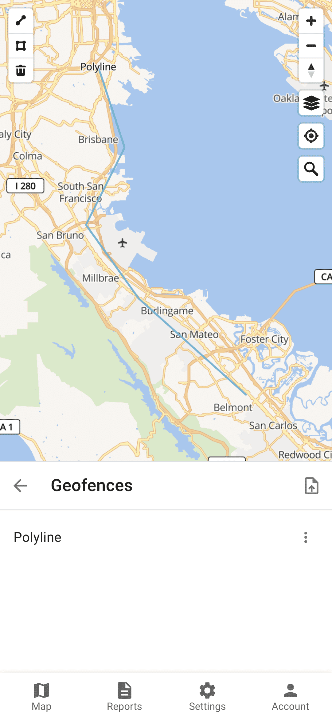
Polyline Geofence
A polyline geofence is a user-defined geographical boundary represented by a series of connected line segments. This type of geofence is used to monitor and track the movement of devices along a specific route or path. For a device to be considered within the polyline geofence, it must be within 25 meters of the line. The system can generate events to notify when the device deviates from the path, enters, or exits the polyline geofence. Polyline geofences are particularly useful for monitoring transportation routes, hiking trails, and other linear pathways.
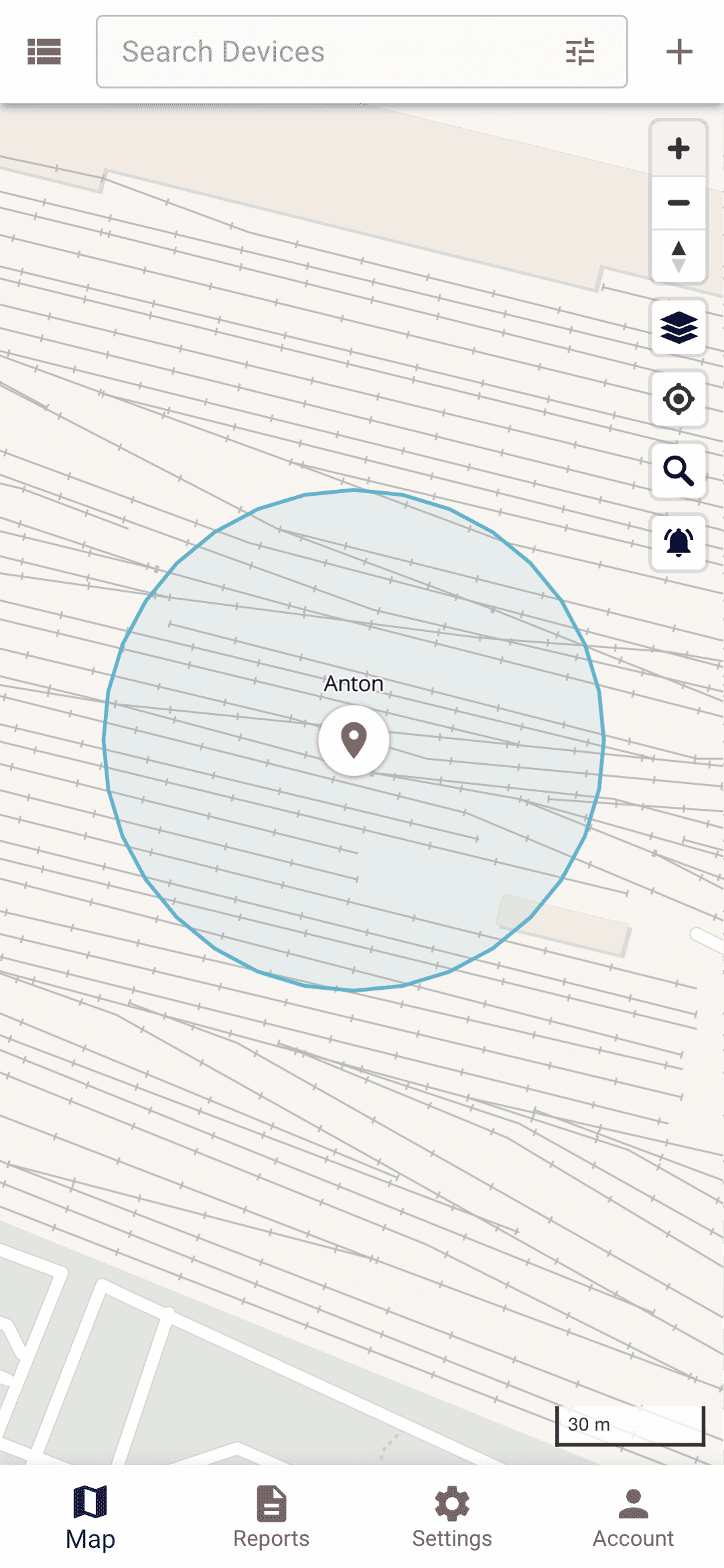
Circle Geofence
A circle geofence is a user-defined geographical boundary with a specified center point and radius, forming a circular area. This type of geofence allows for monitoring and generating events when a device enters or exits the defined circular zone. Circle geofences are simple to configure and are particularly useful for monitoring areas with a central point of interest, such as a building, parking lot, or any circular region where precise boundary monitoring is required.
Permissions
If a geofence is linked to a device, it means that the system will monitor device entering and exiting that geofence.
If a geofence is linked to a group, it means that the system will monitor all devices in that group entering and exiting the geofence.
If a user has access to a geofence, it means that the user can edit/remove the geofence and can subscribe to the geofence events.
Calendars can be linked to geofences. It will limit events generation to the calendar schedule.
Other Information
The color of a geofence on the map can be set in the geofence attribute color. Any valid HTML colors are accepted.
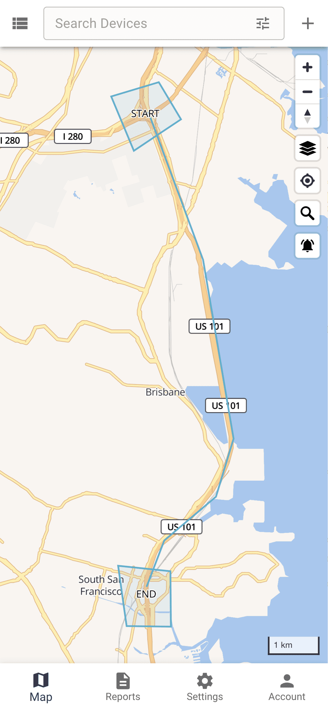
If you need to control device movement along a predefined route, you can use a polyline geofence. Also, if you need to control when a device started and ended the route, you can add additional geofences at the start and at the end.
Link to Device
Once you have set up your geofences, the next step is to link them to a device. This linkage enables the system to monitor the device's movements in relation to the defined geofences and generate events when the device enters or exits these zones. By associating geofences with specific devices, you can ensure accurate tracking and receive timely notifications about the device's activities within the monitored areas.
To link a geofence to a device, navigate to the device's settings page. From there, go to the "Connections" section of the device settings. In this section, you can select and link the geofences you have created to the specific device. This setup ensures that the system will monitor the device's movements in relation to the linked geofences and generate appropriate events based on its location.